Teacher resource collection
Mapping activities for middle-school classrooms
Choose one question, a small study area and a final product students can explain. These activities adapt our existing classroom guides for a middle-school lesson or short project.
Treat the scope as a teaching suggestion, not a curriculum requirement or a Google account eligibility rule. Adjust reading difficulty, supervision, time and tool access to your class.
Prepare the lesson
Start with the teacher workflow and use the Maps, My Maps and Earth comparison when the tool choice is unclear. Preview the exact resources and school-approved access before teaching.
Supply a short public-source packet when independent research would take time away from the geographic task. A paper map and the same feature table are alternatives when devices or accounts are unavailable.
- Write the question and study boundary.
- Choose evidence students will read or collect under supervision.
- Name the map or sketch, feature table and explanation required.
- Set audience and privacy rules before adding information.
- Share the relevant rubric rows before work begins.
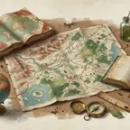
Geography: a watershed and its neighbours
Learning objective: Explain a spatial relationship using public evidence.
Suggested adaptation: Provide a teacher-selected public watershed map and a small set of public land-use records. Ask pairs to select three places and explain why their location in relation to water matters.
Final product: A labelled map or sketch and three claim–evidence–source captions. Add one question the records cannot answer. Do not interpret a possible pollution source as proven contamination.
History: confirmed and uncertain places
Learning objective: Separate a source’s named place from a precise location inferred by the student.
Suggested adaptation: Give pairs a brief primary-source packet about one documented journey or event. Limit the map to three or four places. Label each confirmed, approximate or unresolved, explaining one uncertain choice.
Final product: A numbered sequence, each source reference and a sentence about evidence that could settle a disputed location. A neat route line does not prove the exact path.
Science: propose sampling sites
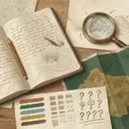
Learning objective: Explain how site selection can change the evidence a study collects.
Suggested adaptation: Use a public park plan or teacher-approved site. Pairs propose three sampling locations for a named variable and reject a fourth, giving a reason about spacing, access or bias.
Final product: A proposal map and methods box. Proposed points are not measured results. Real fieldwork requires school permission and supervision; the planning lesson can stay in the classroom.
Mathematics: different measurement questions
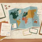
Learning objective: Name a measurement method, keep units consistent and explain why two numbers may answer different questions.
Suggested adaptation: Choose two public landmarks and compare a direct gap with a route or deliberately traced path. Use the detailed measurement guide to select the supported method. Start with two rows; add conversion when it fits the class.
Final product: Method, units, result and a reason for the difference. Platform measurements are estimates, not property surveys or unsupervised travel instructions.
Literature: three places that change the story
Learning objective: Use setting as evidence for an interpretation, rather than retelling the plot.
Suggested adaptation: Choose three important settings from an assigned text. Give a chapter or page reference and explain how each affects a character’s choice, mood or conflict.
Final product: A sequence map or sketch and an interpretation paragraph. Label fictional, composite and inferred places; an imagined setting does not need a guessed real coordinate.
A manageable lesson sequence
Shorten research by supplying sources, or extend revision when the project forms part of a larger unit.
| Stage | Student move | Evidence of learning |
|---|---|---|
| Frame | Write the question and boundary | A question that governs which places belong |
| Research | Record sources for proposed features | A small source table with uncertainty notes |
| Represent | Add labels, captions and a text legend | A readable map or sketch plus equivalent text |
| Explain | State a claim and a complication | A short written or spoken explanation |
| Revise | Respond to one focused comment | A corrected source, qualified location or clearer explanation |
Privacy and access before sharing
- Use public places, generalised areas or explicitly fictional examples.
- Exclude student homes, personal routes, live locations and unnecessary identifying details.
- Use school-approved accounts and sharing; do not bypass a restriction with personal accounts.
- Keep meaning in labels and text as well as color. Describe images and provide a feature table or script.
- Assess the geographic explanation when a student needs a paper or text alternative.
Assess and extend
Choose relevant rows from the printable assessment rubric and explain adaptations before submission. For a quick activity, emphasise question, sources, spatial thinking, accessibility and ethics. A longer group project can also make process and presentation evidence explicit.
Use the written walkthrough to model the journey. Browse the tutorial gallery for a technical task, or return to the mapping lesson ideas for another subject.